Dipping in to Rutland County and its slate heritage in August 2023
Cumulative Official Town Count | Cumulative Unofficial Town Count |
|---|---|
7 | 4 |


On a somewhat dreary 251 day in August, we dipped into western Rutland County (bordering New York) and explored 4 official towns, and 3 and a half unofficial towns in Vermont.
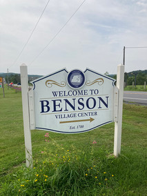
For years now, I've been passing a seemingly random taco truck in a field in Benson, always hoping to try it but never driving by when it was open. Well today was our lucky day! Or not, as the case actually was -- the food was meh at best and I will no longer lament my poor timing as I drive by that spot. While it may well be the only food available in the town of Benson, VT, I still can't recommend it (it tasted to me like everything came out of Tostitos packages); West Coast Tacos, my you-know-what! Unless it was the West Coast of Benson, that is. The town is rural, and other than a town hall/ museum (of what we couldn't tell) and a library, we didn't see much other than homes. However, Cobble Knoll Orchard is located in Benson and is a boutique apple orchard, so I will definitely be heading there next fall to try some of their boutique varieties!
Benson Landing, an unofficial non-town despite its appearance on the map, apparently used to have some sort of Champ (the Lake Champlain monster) structure in the water, but there was none visible. So, while that excursion was a bust for us, if you like to fish, apparently it's a pretty good spot!
West Haven is one of the smallest official towns we've seen (pop was 239 in 2020). In its heyday, it was an agricultural center and transportation hub due to its proximity to Lake Champlain and the Poultney River (before the railroad was built in nearby Fair Haven, which West Haven was originally part of). In fact, the town was large enough to support 7 (small, I assume) schools, all with one rotating teacher! Now, though, all the school children go to Fair Haven for their education.
For a town known the slate capital of the country, it was amusing to see how much marble there is in Fair Haven -- 2 mansions bordering the large town green and others around town. The town clearly has an industrial past (as a mill town then as a slate town) , and while it may not be a thriving metropolis today (even by Vermont's standards), it's a real town with a commercial heart, town green, and nice neighborhoods.
Just down the road (old route 4 (4A), is the official town of Castleton and two unofficial towns which are shown on our map: Hydeville (has its own post office, as well as an old school building and a church which has been converted to a residence) and Blissville (with a hidden old cemetery filled with many gravestones of the Bliss family, after whom we assume this non-town/neighborhood was named).
Castleton is a lovely town and home to Castleton College (part of the Vermont State University system). Is has a cute general store, pizza place, diner (with shockingly good homemade onion rings), and a number of historic graceful mansions and churches lining Main Street. One of the buildings at Castleton College housed Vermont's first medical school, which is now set up as an historical site.
And, lastly, there's Lake Bomoseen, a large recreational lake on the shores of which lies a state park which has a slate history trail. A disappointing trail, if truth be told, and one which actually lies outside the border of the park. The ruins from an old saw mill, made of slate (of course), was spooky but impressive and is being taken over by the woods in which it is located. The trail is very well-marked and maintained, but the 8 stops along it are less than impressive -- the quarry looks like a murky pond. The West Castleton Railroad & Slate Company set up a town for all its workers supporting the thriving slate industry in the mid-1800s, West Castleton, which no longer exists except for the sign and three of the buildings which housed employees and are now privately owned.
Stay tuned for more installments!
Comentarios